tennessee_aeronautics_chart
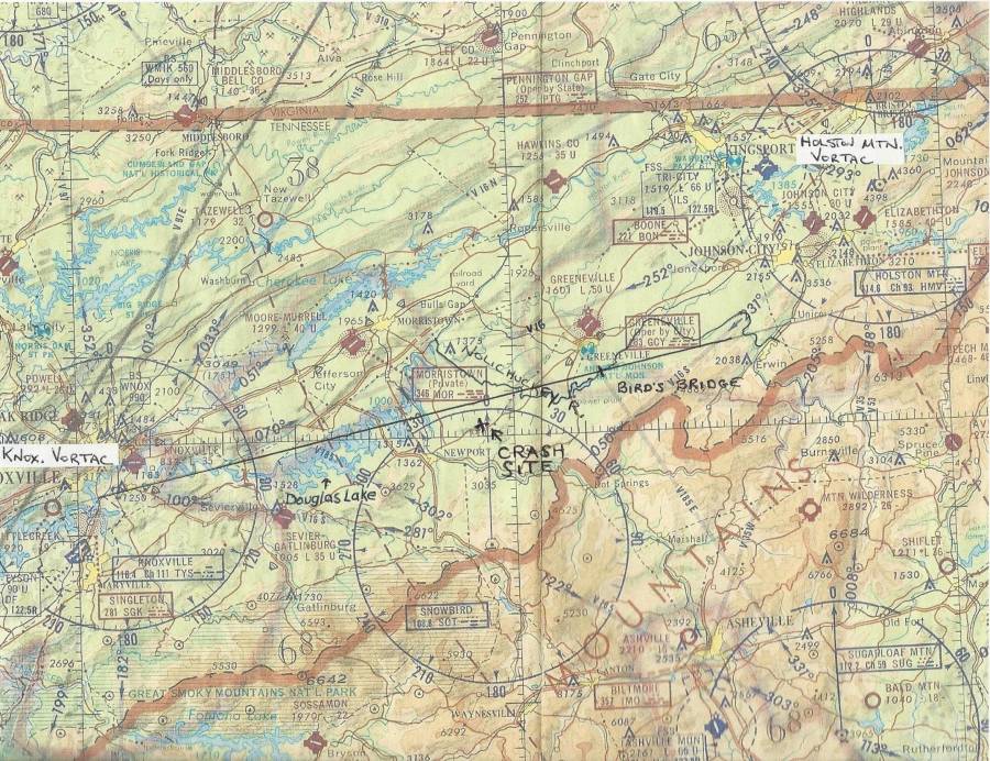
Tennessee Aeronautics Chart
This map is a portion of a 1971 Tennessee Aeronautics Chart authorized by then-Governor Winfield Dunn.
The line drawn from the Bird's Bridge intersection at the Nolichuckey River, southwest, to the Knoxville Vortac has been drawn by me and should not be mistaken for an official navigational vector.
The map will be used as future reference.
tennessee_aeronautics_chart.txt · Last modified: 2013/11/30 16:48 by tom

